Past, present and future…
| M | T | W | T | F | S | S |
|---|---|---|---|---|---|---|
| 1 | 2 | |||||
| 3 | 4 | 5 | 6 | 7 | 8 | 9 |
| 10 | 11 | 12 | 13 | 14 | 15 | 16 |
| 17 | 18 | 19 | 20 | 21 | 22 | 23 |
| 24 | 25 | 26 | 27 | 28 | 29 | 30 |
Every blogger has a beginning…
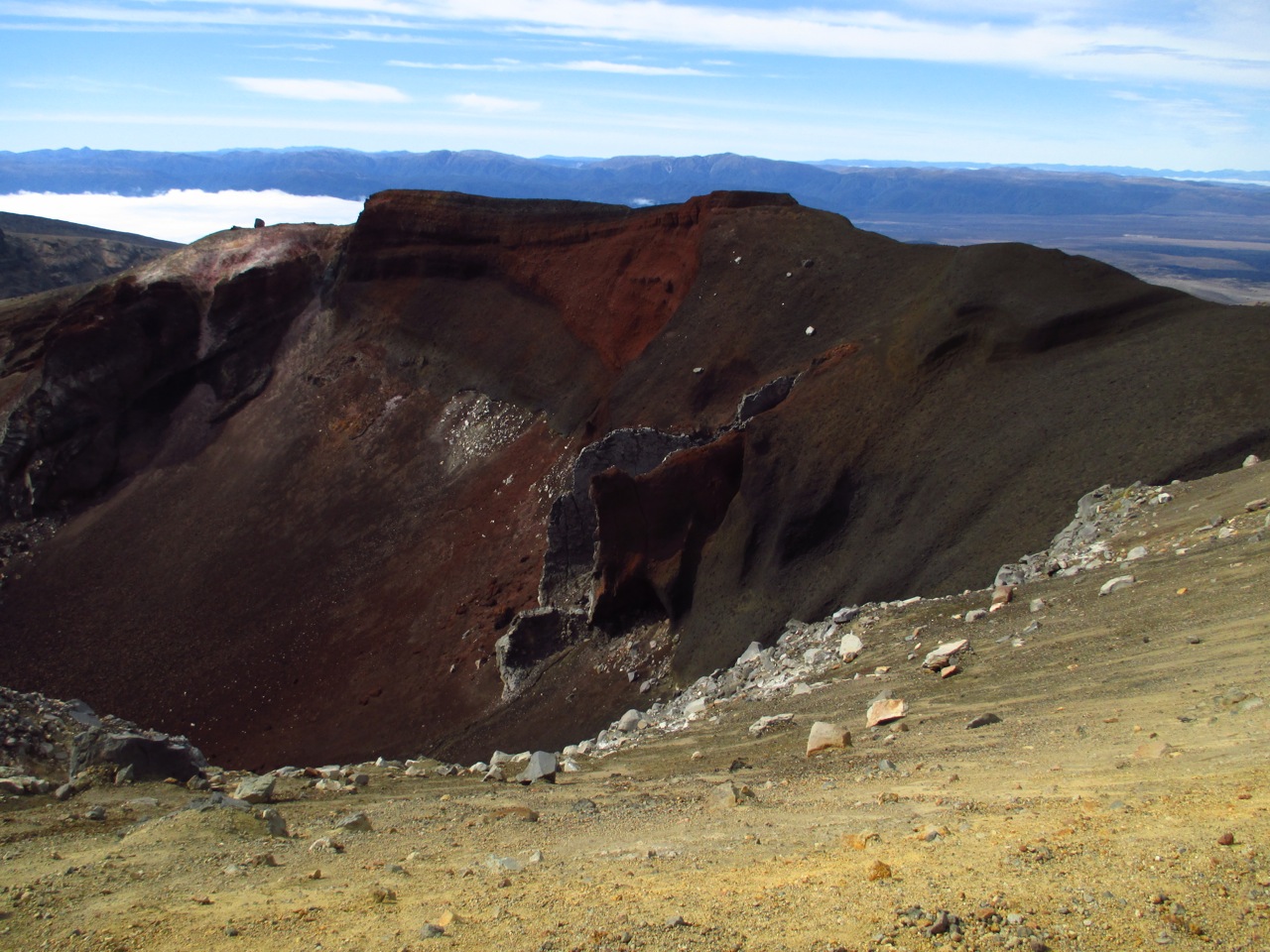
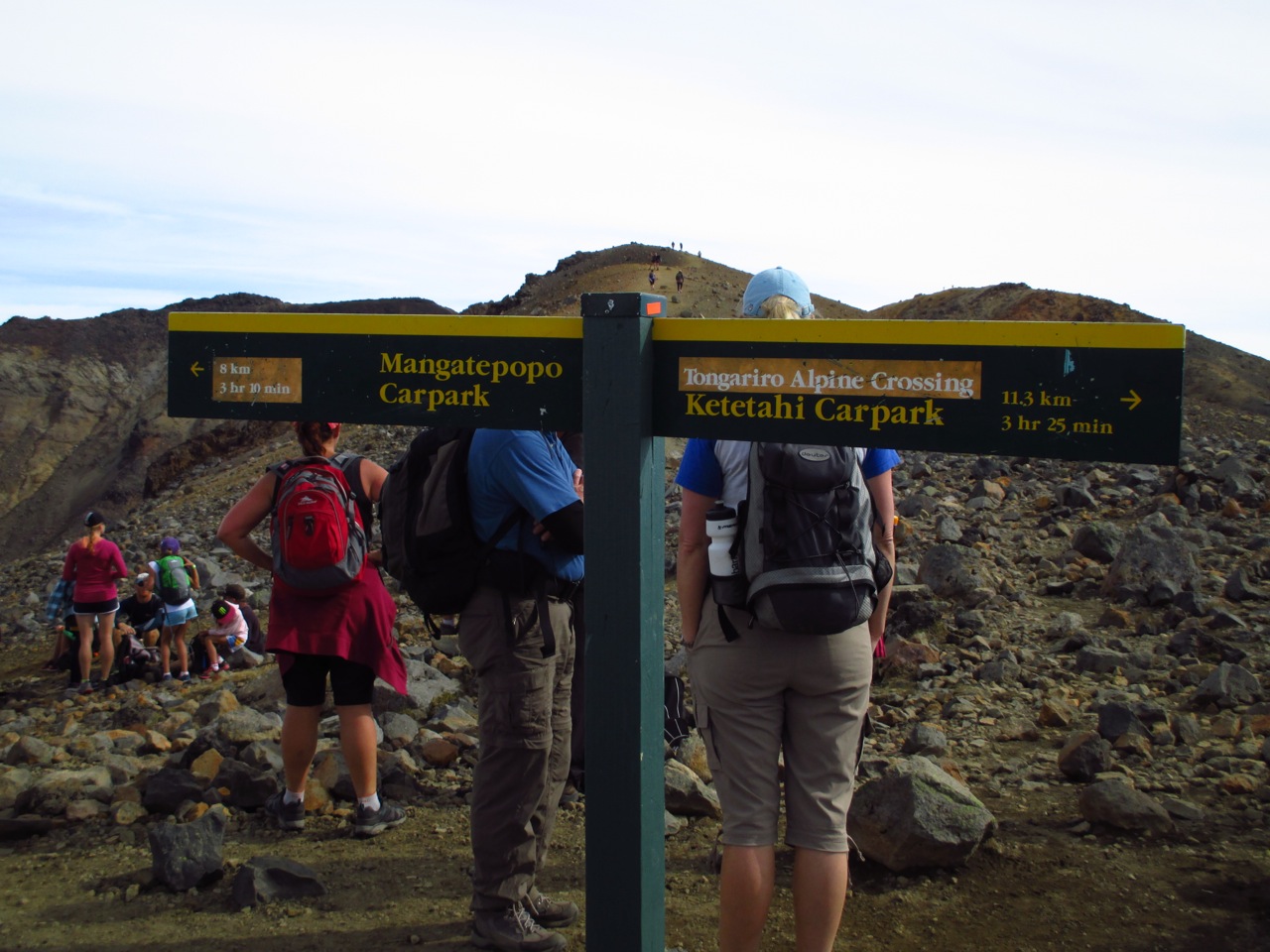
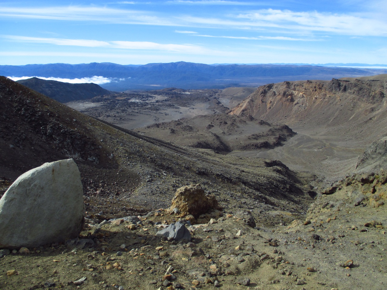
One of the most beautiful and challenging tracks in New Zealand is Tongariro Alpine Crossing. Two weeks ago, we decide to give it a try. 🙂 It was one of the most challenging things I have done from a physical and mental point of view, but it was well worth it. Although it is hard work and the body is under serious stress, the views are absolutely amazing. Also getting to the end of it, is a wonderful rewarding experience, that I would recommend to anyone that loves the mountains.
The crossing is for those with above medium level of fitness, otherwise it is quite a struggle. For myself, it was pretty close to the end of my physical abilities and I would say that if you have any doubts about your level of fitness don’t try it. The track is 19.4 km longs and takes on average 8h to complete, depending from which direction you start. The recommended way to do the track is from Mangatepopo Car Park to Ketetahi Car Park. Nothing stops you from doing it from the other direction, but in this case allow for extra 2h to complete it. From an altitude perspective you start at around 1000m, climb to 1900m at the highest point and then descend to 800m.
What we had with us:
The track is divided into several sections, quite different between them:
And this was the end of the track. Tired and barely moving I got to the end of it. Felt a huge relief and I was really proud of myself that I took the challenge and pushed my physical limits to do this track. Anyone who loves the mountains and is up to a good challenge, don’t hesitate to try it. And who knows… you might like it so much that you will return the next year as well ;)…


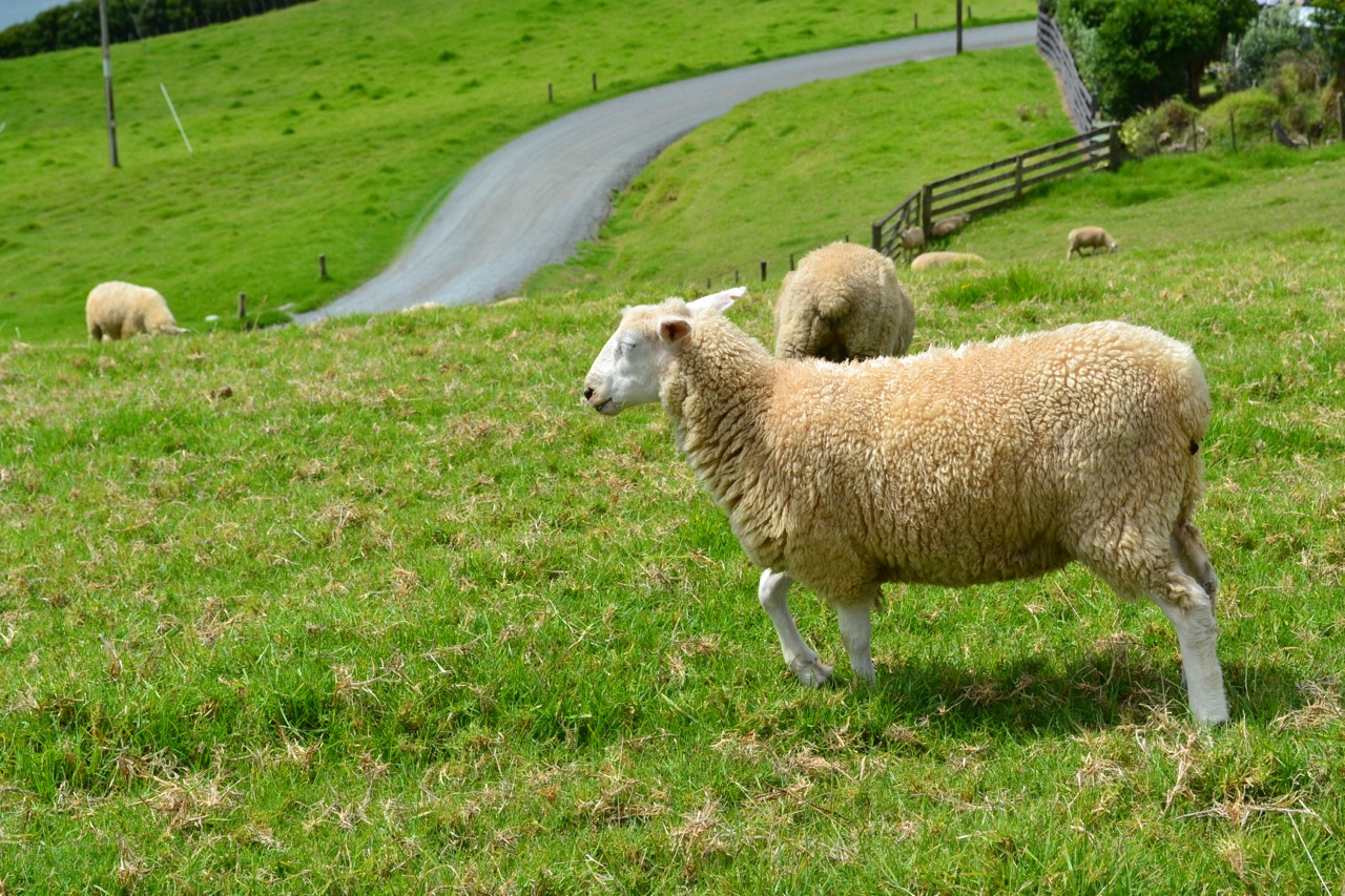
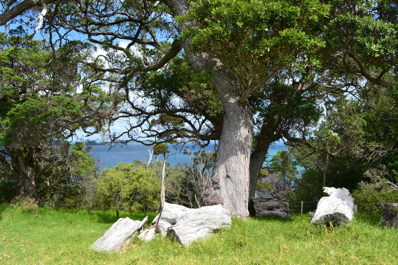
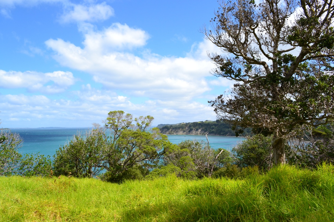
Last week we have decided to check Scandrett Regional Park, around one hour far away from Auckland. The park is located on a nice peninsula that offers lovely views over Kawau Bay and Kawau Island. The weather was perfect for walks, not too hot and with a little bit of clouds.
You get to Scandrett by taking State Highway 1 to Warkworth and then following the signs to Snells Beach. From there onwards, you just follow Mahurangi East Road and Martins Bay Road that takes you exactly at the park’s entrance.
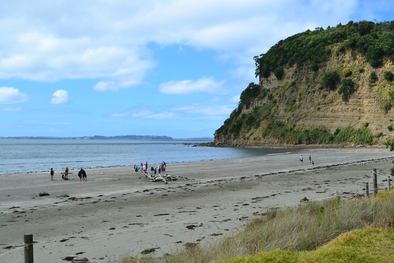
The park itself is not very large, but does provide beautiful walks with amazing views. We decided for a perimeter track, which encompassed 3 tracks (around 1h and 30min): Mullet Point Track, Kawau Bay Track and Orchard Track. The Orchard Track gets you next to an old, historical farm, which is worth having a look at and especially the garden surrounding it. Past the farm, the track takes on a quiet beach, with warm waters and white fine sands. The last part of the track is quite a steady climb and requires a good level of fitness, otherwise you will find yourself making breaks more often than you would like to.
In the park you can also find nice picnic spots, camping sites and Auckland Council provided holiday bachs. I would definitely recommend it as a good spot to spend the weekend or just for a sunny picnic day.


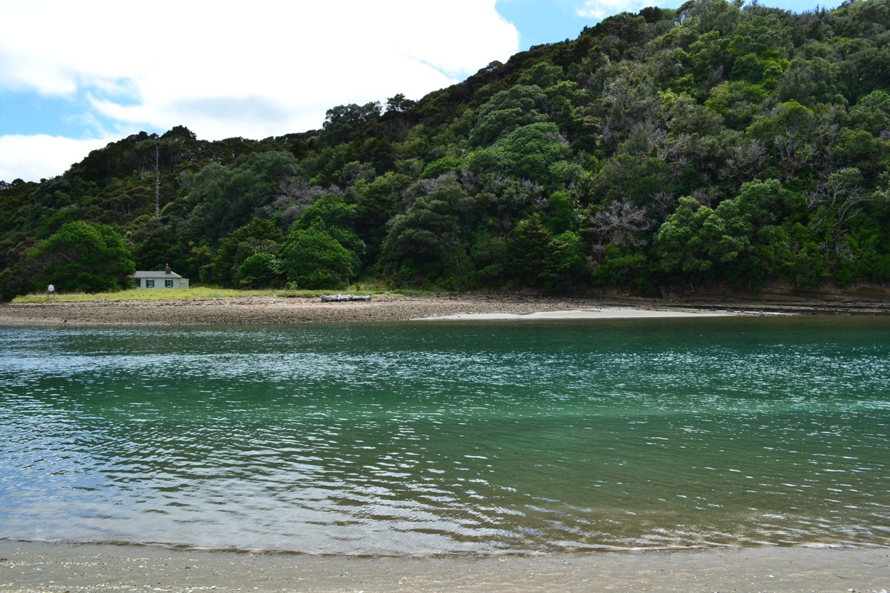
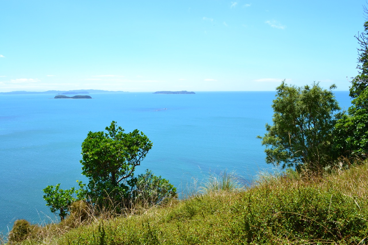
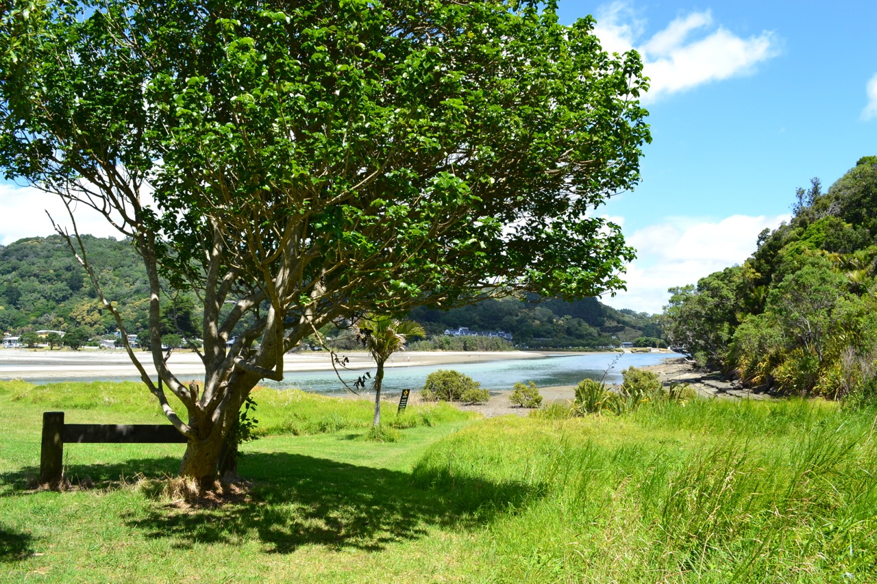
Today was a great day to be outside and enjoy the sun and good weather after not such a great week (dark, gloomy and windy). We decided to check another regional park near Auckland called Wenderholm. We were well rewarded by stunning views and a total disconnect from city life.
You get to Wenderholm by following the Hibiscus Coast Highway and then Shischka Road. Pretty easy to get there and a great spot for picnics and bbq. When we got there, there were quite a few people enjoying the good weather and the great spot to spend time with friends and family.
As we had plenty of time we decided for two tracks:
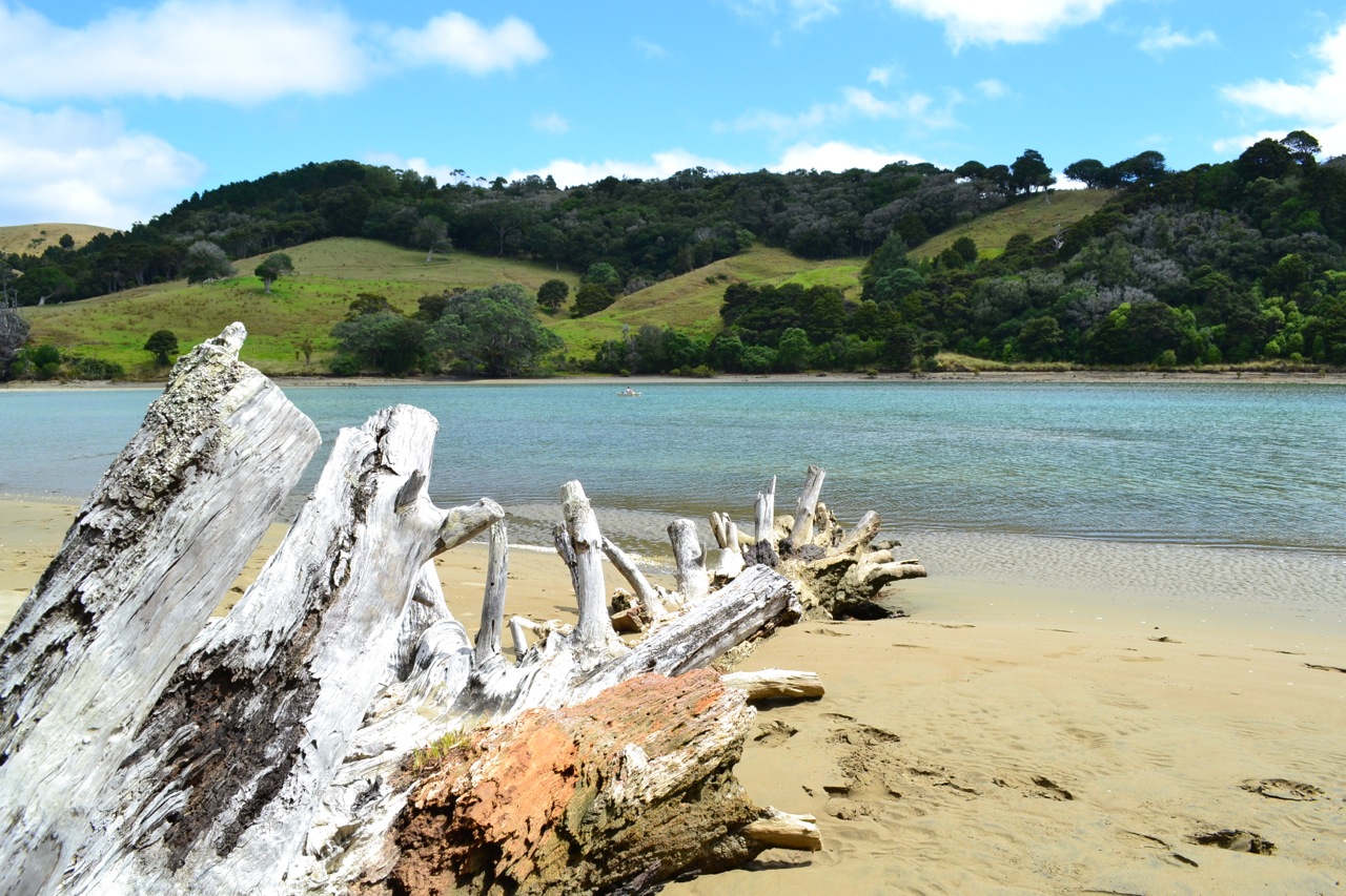
1. Te Akeake Walk – 30 minutes, 1km. This is an unmarked track, going north from the carpark. You just head along on the beach and surround the small peninsula. We experienced really nice views and lots of aquatic birds foraging for food as it was low tide.
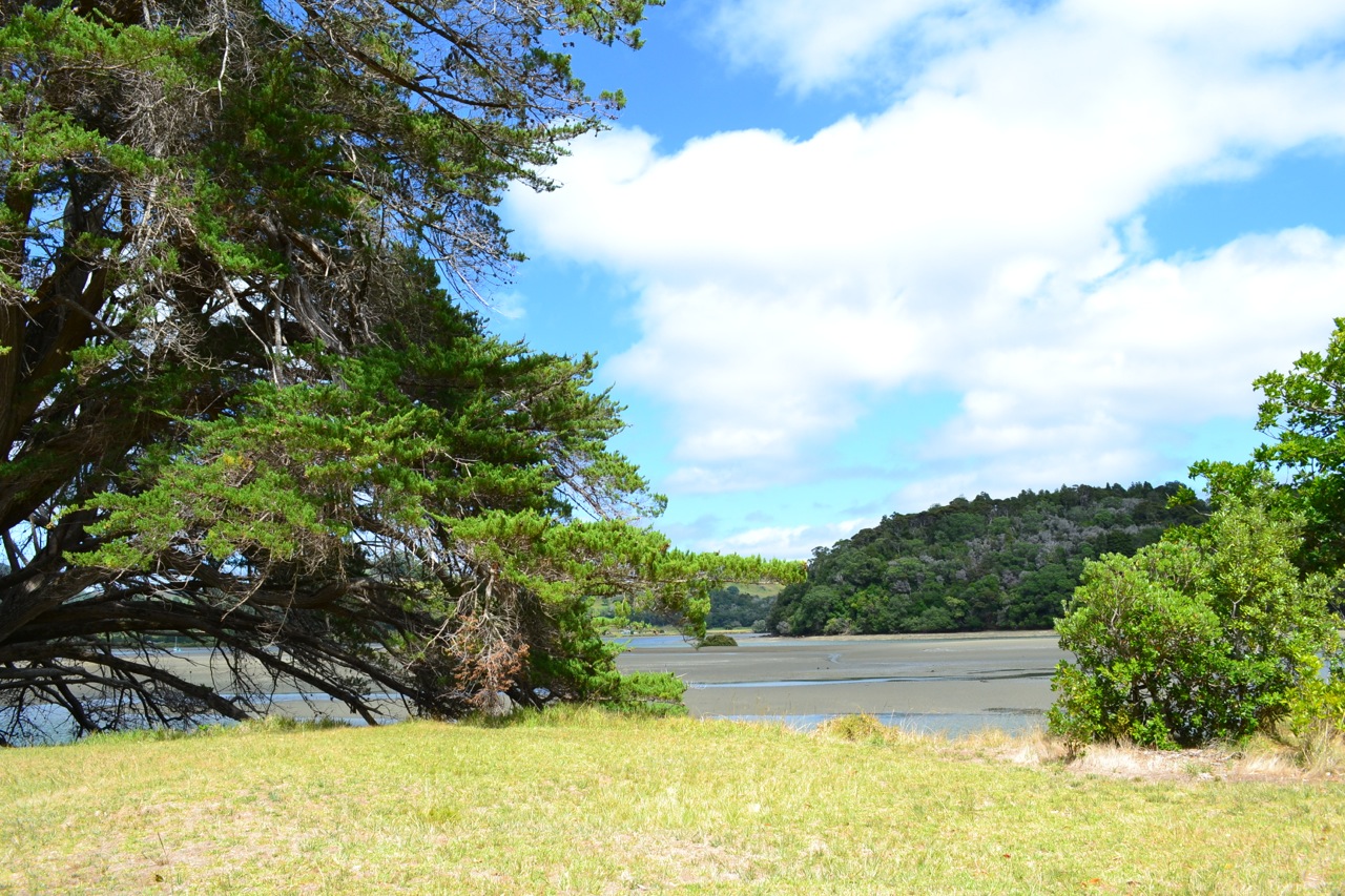
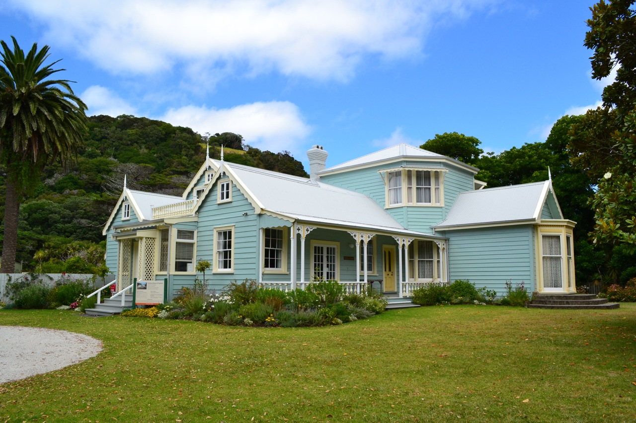
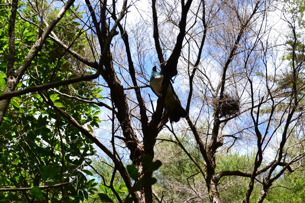
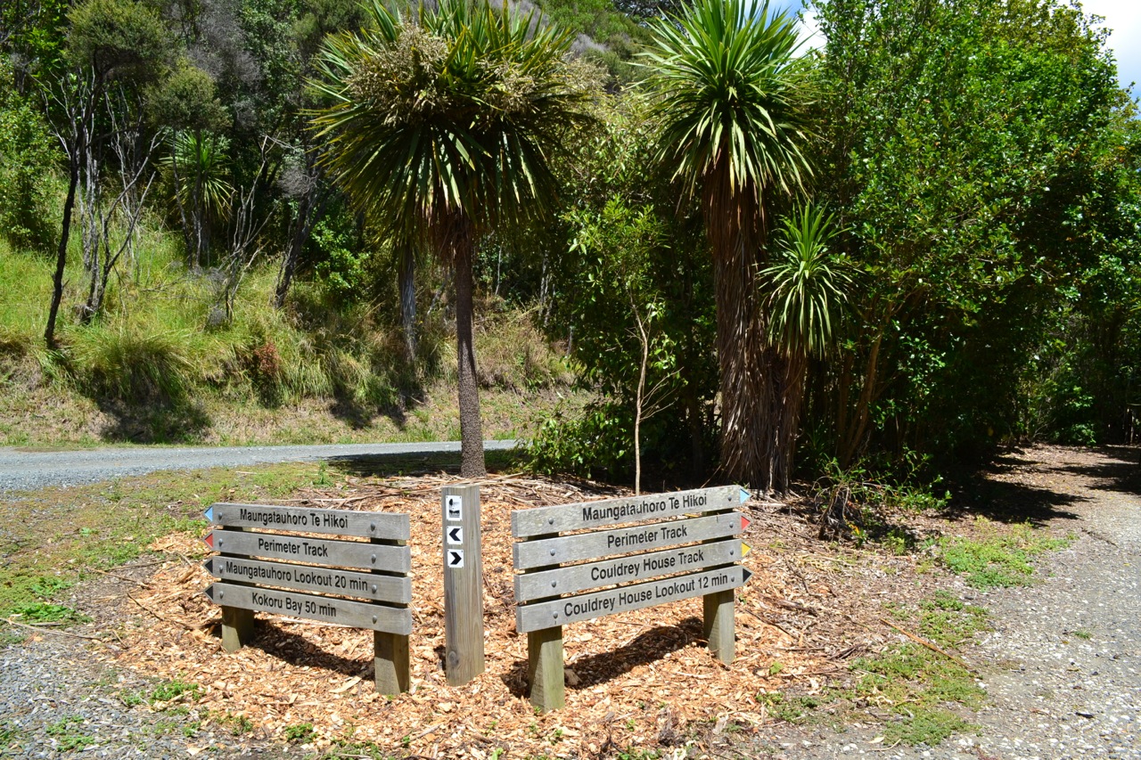
2. Perimeter Loop Track – 2 hours, 4.6km return. This track starts near the Couldrey House, which is a nice historical site, worth having a look at. Passing the house you will end up at an intersection, where I suggest taking left as the track is far easier to be done from that side. The track requires moderate level of fitness as some parts of it are quite difficult and are marked as tramping track. The road is not quite well defined in these spots, but going downhill makes it so much easily approachable. There are several lookouts along the path and the views are just stunning.
🙂 🙂 🙂 Definitely a great spot for picnics, with lots of BBQ and tables and benches. The place also provides a camping area, if you decide to spend more than a day. I would also mention the walking tracks as a great way to exercise and spot some native birdlife.


The summer which was not very friendly this year decided for a 180 degrees change and gave kiwis an opportunity to enjoy a nice, long, sunny weather time. I could say that it is actually a nice late autumn that delights us with perfect weather, but I really like to think that summer is still here somehow. 🙂
So the past weekend we decided to take advantage of this awesome clear, blue sky and do a short two days trip to Rotorua. The main target of the trip was “Te Waihou Walkway” (Blue Springs). The walkway is pretty far from Auckland and it takes about 3 hours to finish it. But the efforts are well spent and the views are just a real treat for both mind and heart. The waters of the river are so clear that, at least in the morning, have a bright light blue colour. The Blue Spring is internationally acclaimed, as it takes over 100 years for the water coming from the Mamaku Plateau to reach it. During this long residence in aquifers, particles and light-absorbing matter are effectively removed from the water, leaving it with a very high clarity and characteristic blue-green colour.
After a long and a bit tiring day, we spent the night in Rotorua, where we enjoyed a fabulous dinner at a local Mexican restaurant called Sabroso. And because we were in Rotorua, we ended the day with a relaxation time at one of the local thermal pools, “Waikite Valley Thermal Pools“.
The next day was dedicated to walks in The Redwoods, one of the iconic locations in Rotorua. Most of the forest is man planted 🙂 and gets its reddish looks from Californian Coast Redwood (Sequoia sempervirens). The area is full of tracks for walking, running, hiking, bicycling or horse riding. The forest is at times quiet or full of sounds: children laughing, dogs barking, birds singing. Also it smelled a lot like pines… couldn’t stop remembering the pine forest I visited as a kid in Romania.
Sunday evening we were back at home… tired but pleased. The nature was surprising and offered us so much diversity. But this is New Zealand in the end. Always amazing… always different.
